topoKorea

A component that automatically generates maps in a short time by categorizing 1:1000 scale SHP files
source code : https://github.com/bic98/topoROK
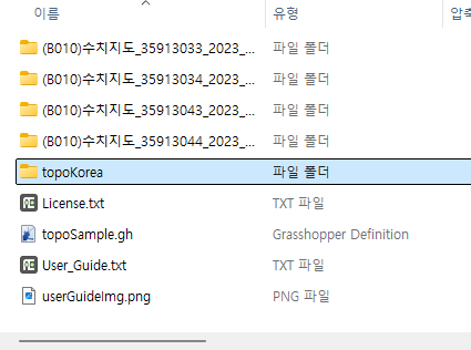
When you download the file, a user guide is included.
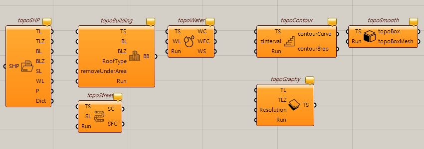
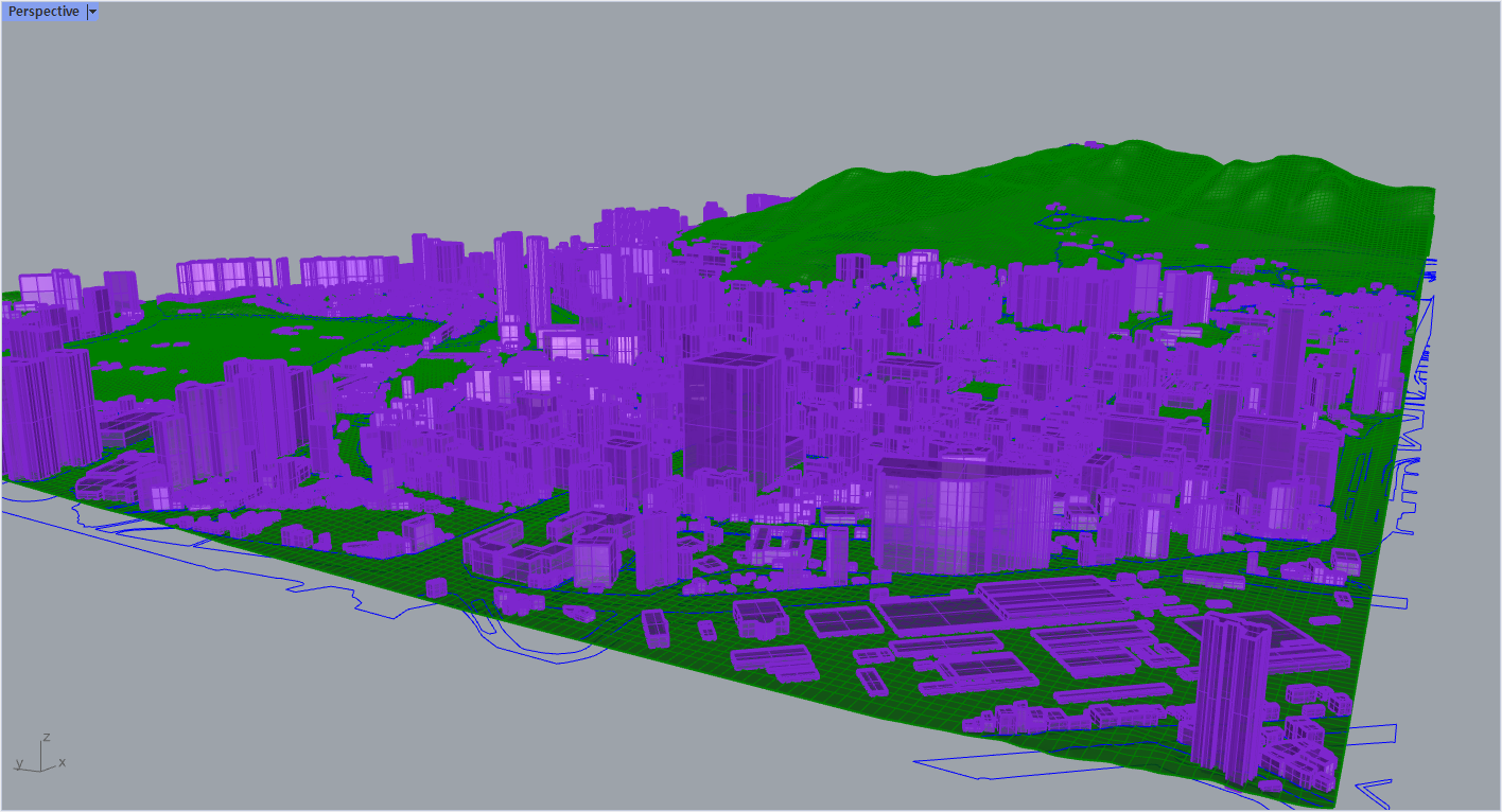
This component allows for the rapid and automated generation of maps using 1:1000 scale SHP files provided by the National Geographic Information Institute of Republic of Korea. It distinguishes itself with advanced features such as adding contours to terrain data for more detailed topographic representation and applying parapets to building structures for enhanced architectural visualization. By leveraging parallel processing, this tool handles all map elements simultaneously, significantly reducing processing time and ensuring incredibly fast map creation. Designed for developers and GIS professionals, it offers a powerful and efficient solution for creating comprehensive, high-quality maps in a fraction of the time.
- Rapid and automated map generation using 1:1000 scale SHP files from the National Geographic Information Institute of Korea.
- Adds contours to terrain data for detailed topographic visualization.
- Applies parapets to building structures for realistic architectural representation.
- Utilizes parallel processing to handle all map elements simultaneously, ensuring fast map creation.
- Merges multiple SHP files into a single, cohesive map, overcoming size limitations of existing maps.
- Ideal for developers and GIS professionals to create high-quality, large-scale maps quickly and efficiently.
1:1000 축척의 SHP 파일을 분류하여 단시간에 지도를 자동으로 생성하는 컴포넌트입니다.
소스 코드 : https://github.com/bic98/topoROK
파일을 다운로드하면 사용자 가이드가 포함되어 있습니다.
이 컴포넌트는 국토지리정보원에서 제공하는 1:1000 축척 SHP 파일을 사용하여 지도를 빠르고 자동으로 생성할 수 있는 컴포넌트입니다. 지형 데이터에 윤곽선을 추가하여 보다 상세한 지형을 표현하고 건물 구조에 난간을 적용하여 건축 시각화를 강화하는 등 고급 기능으로 차별화됩니다. 이 도구는 병렬 처리를 활용하여 모든 지도 요소를 동시에 처리하므로 처리 시간이 크게 단축되고 놀랍도록 빠른 지도 생성이 가능합니다. 개발자와 GIS 전문가를 위해 설계된 이 도구는 단시간에 포괄적인 고품질 지도를 만들 수 있는 강력하고 효율적인 솔루션을 제공합니다.
국토지리정보원의 1:1000 축척 SHP 파일을 사용하여 신속하고 자동화된 지도를 생성합니다.
지형 데이터에 윤곽선을 추가하여 상세한 지형 시각화를 제공합니다.
사실적인 건축물 표현을 위해 건물 구조에 난간을 적용합니다.
병렬 처리를 통해 모든 지도 요소를 동시에 처리하여 빠른 지도 생성을 보장합니다.
여러 SHP 파일을 하나의 일관된 맵으로 병합하여 기존 맵의 크기 제한을 극복합니다.
개발자와 GIS 전문가가 고품질의 지도를 제작하는 데 이상적입니다.
설치방법
1. food4rhino에서 topokorea를 다운 받는다.
사용하는 라이노 버전에 맞는 버전을 선택한다.
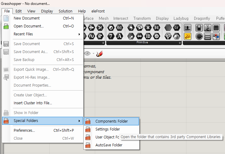
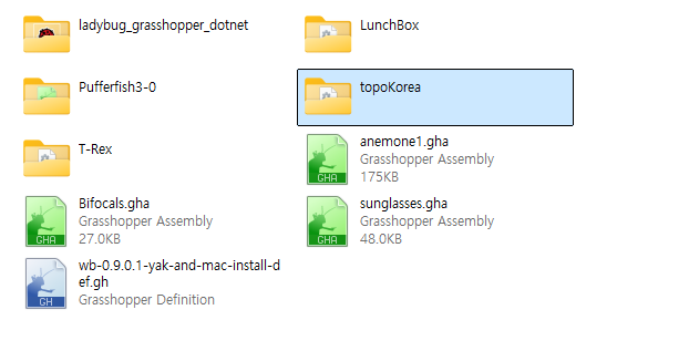
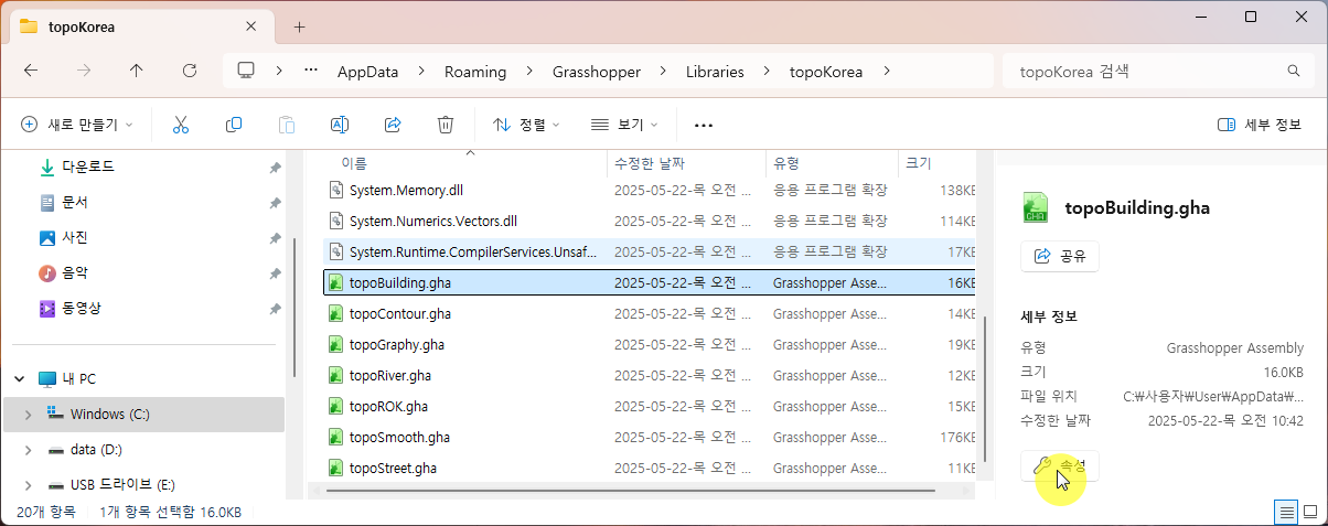
2. 다운받은 압축파일에서 topoKorea 폴더 전체를 복사한 후
C:\Users\User\AppData\Roaming\Grasshopper\Libraries에 붙여 넣는다.
Libraries폴더는 아래 그림을 참고하세요.
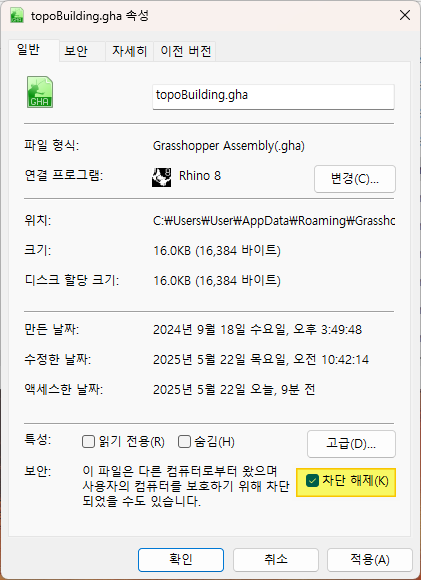
3. gha파일을 선택한 후 속성을 클릭한 후
속성창에서 차단 해제 체크한다.
4. Rhino를 재실행한다.
topoKorea가 로드 된것을 확인 할 수 있다.

https://youtu.be/wV_jQ9y3pxA?si=vdZPOxqEzrYBjrLa
1. 국토지리정보원 홈페이지에서 항공사진 지도받기
https://www.ngii.go.kr/kor/main.do
국토지리정보원
www.ngii.go.kr
RMB 클릭 > 공간검색 > 영역설정
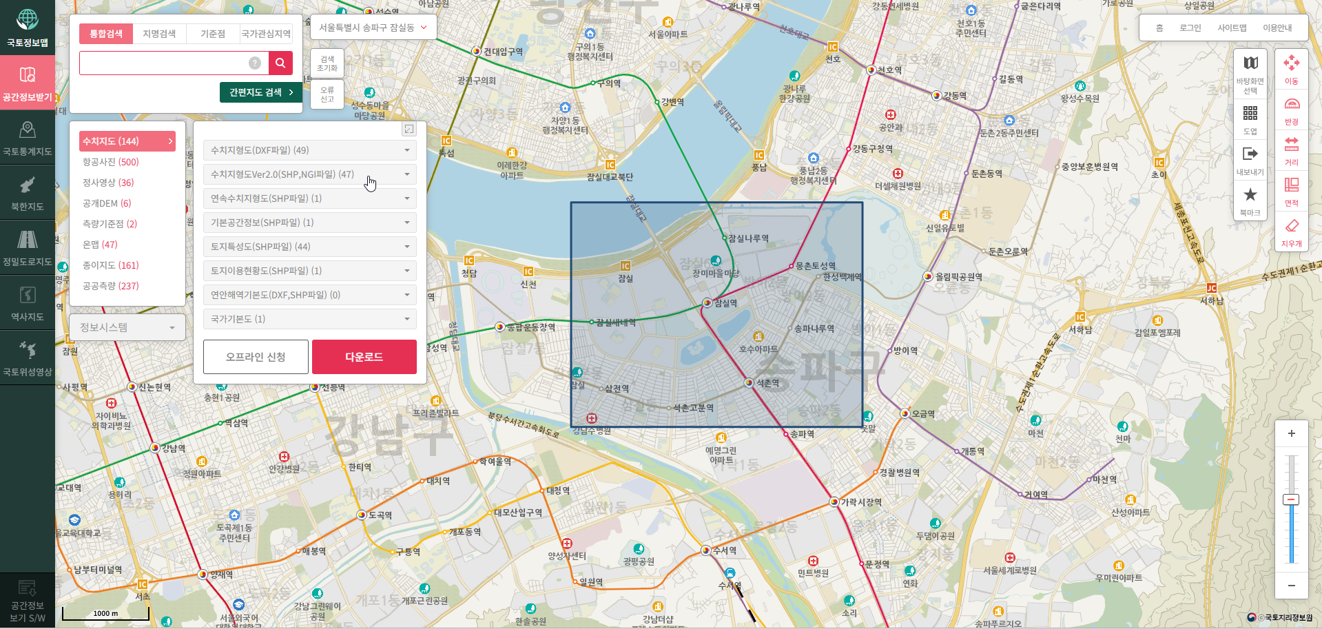
수치지도 / 수지지형도Ver2.0(SHP,NGI파일)
영역에 필요한 지형도 선택

전체다운로드 클릭
신청서 작성 및 사용자 준수사항
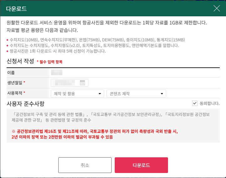
공간정보관리법 제16조 및 제21조에 따라, 국토교통부 장관의 허가 없이 측량성과 국외 반출 시, 2년 이하의 징역 또는 2천만원 이하의 벌금이 부과될 수 있음
신청 파일 다운로드


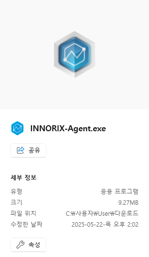
파일이 다운로드가 되지 않을 때에는 다운로드 프로그램(INNORIX-Agent)이 설치되었는지 확인해야 한다.
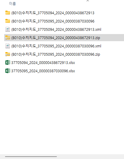
받은 파일 압축을 푼다.
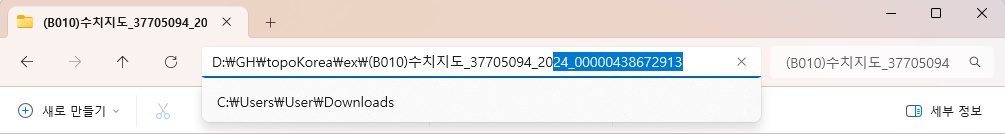
파일 경로를 복사하여 Panel에 붙여 넣는다.
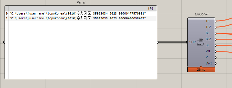
topoSample 파일
'Grasshopper' 카테고리의 다른 글
| Kinetic Sculpture (0) | 2025.05.26 |
|---|---|
| Oculus by Calatrava (0) | 2025.05.19 |
| Split Tree (0) | 2025.05.15 |
| Parabolar (0) | 2025.05.15 |
| Trim, Split, Union, Intersection in Grasshopper (0) | 2025.04.30 |